The Cliffrose Trail System
I crest the top of Turkey Farm Road and pull into the makeshift trailhead just as the sun's morning glow is peaking over the eastern edge of Pine Valley Mountain. I left my house in downtown St. George about 20 minutes earlier and over 10 degrees hotter. Stepping out of the 4Runner, the air feels cool and it's nice to be surrounded by the Juniper trees.
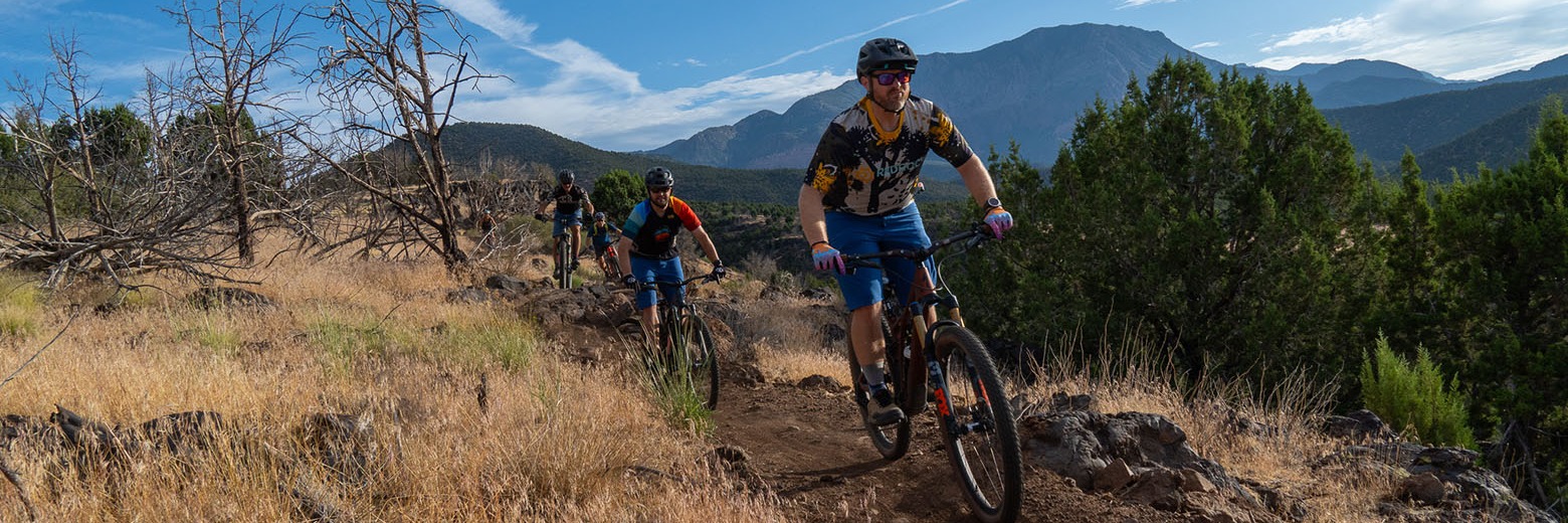
I let the dogs out the back, strap on the shoes and helmet and start pedaling. I haven't been here and quickly feel like I'm riding up what is meant to be a downhill. I reference the map sent to me by Kevin from TASU and yup, I'm going the wrong way. I flip around. The trail is definitely more fun in the direction intended. It takes me across the dirt road and then skirts the edge of the Black Gulch. I've got a special place in my heart for this almost unknown canyon and riding on its rim brings a big smile. That plus the trail is fun. There's a few rock moves and some good texture to keep me interested. A solid blue trail that loops back around and back up to the road.
I find myself at the parking area where most people seem to be starting. Still unsure of where to go, I just keep pedaling crossing the road again and beginning to climb once more.
The trail continues mostly up, but has a few dips thrown in so it doesn't feel like you are just grinding out the elevation gain. There's open grassy areas between the juniper trees. This gives you the best of both options. You get to pedal in the trees but also get the views as you climb higher and higher up the gradual slope.
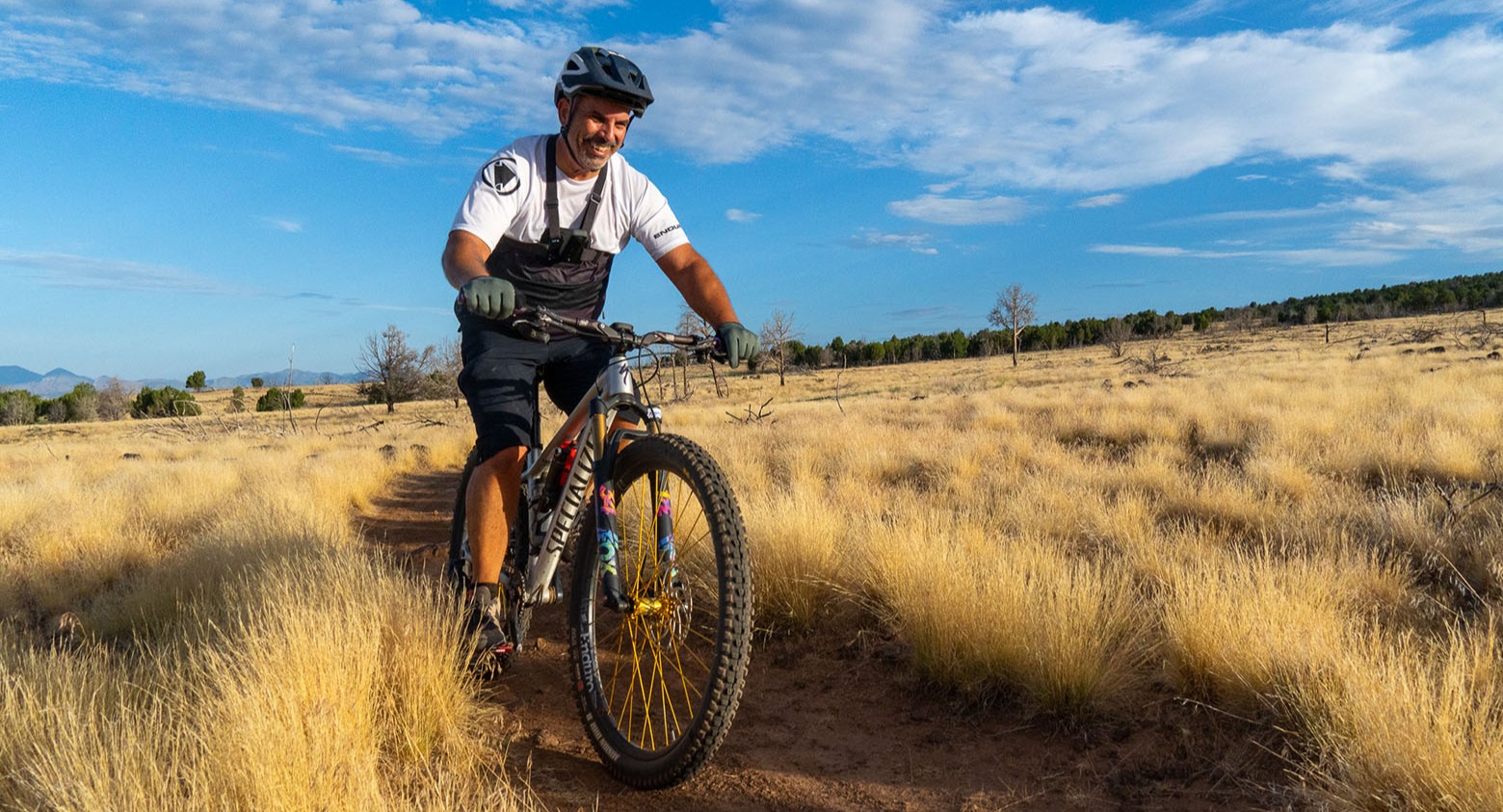
After a few miles, the trail tops out and I'm treated to a flowy, fast, fun downhill with just enough rocks to make sure you are on your toes. I find myself back at the car pretty quickly craving more.
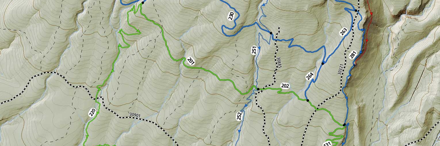
Spring Hollow Trail System on Trailforks.com
Getting there
The trails are so new, that there isn't an official trailhead although we are told one is coming most likely in the fall. Most people are parking and starting at the junction of FR 901 and Cottonwood Springs Road (or if your a local Turkey Farm Road). This means you can either take pavement to Diamond Valley and then drive the few miles of dirt to the junction or you can go up Cottonwood and do the whole journey on the gravel road. I drive dirt roads fairly quickly and found that both ways took about 20 minutes.
What else do you need to know?
There is more construction to come and the trail crew is scheduled to come back this fall once the temperatures are more conducive to all-day construction.
You can download the map at the link below. Most of the trails on the map are ready to go, but there are a few connectors that don't exist.
The trail system's official name is Cliffrose, but most people, including Trailforks, are referring to this as Spring Hollow. We'll see which one sticks.
Also be sure to thank TASU, Dixie National Forest and Washington County for their cooperation in bringing these trails to life. It's been a long road, but it has been well worth it.
Now get out and ride!